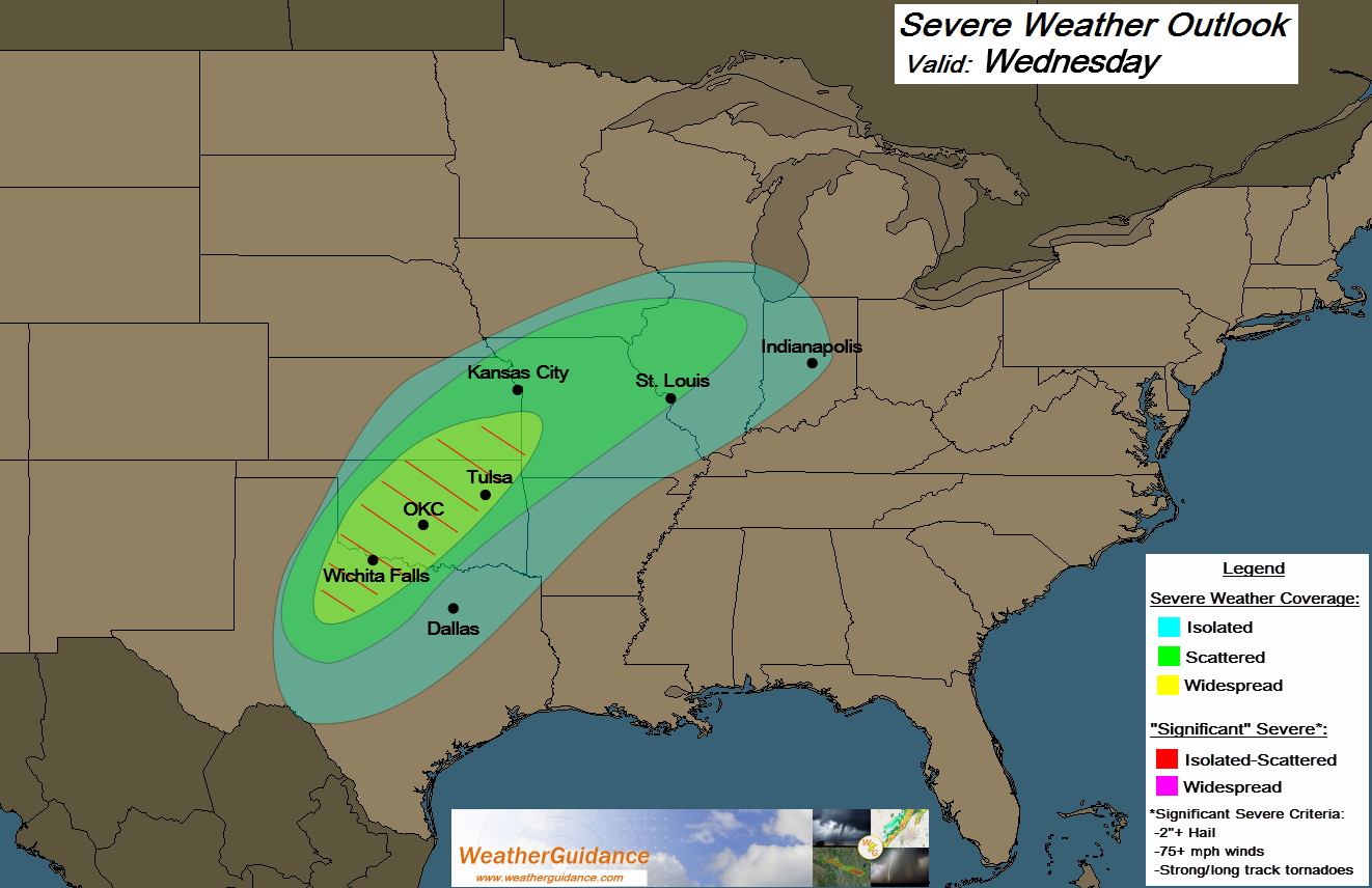
As we've been talking about for several days now, today appears to hold the highest potential for significant severe weather across the central U.S. Above is the latest severe weather forecast for today (which is unchanged from the outlook that we provided yesterday).
I expect strong to severe thunderstorms to become widespread within the yellowish-green shaded area by late this afternoon and this evening. Some of the storms within this area will be capable of producing very large hail (greater than 2 inches in diameter), damaging winds and a few tornadoes. A strong and/or long track tornado is possible in this area.
This enhanced risk of severe weather includes the cities of Wichita Falls, Lawton, Altus, Oklahoma City, Tulsa, Chanute and Joplin. If you live or have travel plans in these areas, please be on a high state of alert this afternoon, evening and tonight.
Elsewhere, a threat of strong to severe storms will exist across a rather broad area extending from northwest and west-central Texas into the Midwest. Large hail and damaging winds are likely with any severe storms that form in these areas, and an isolated tornado cannot be ruled out, especially within the green shaded area.
If you live or have travel plans in the severe weather risk areas for today, please remain alert. Listen to NOAA Weather Radio, local media or another trusted source for the latest information, watches and possible warnings. Make sure to identify the best sheltering option wherever you'll be this afternoon and evening, and be ready to move there quickly if threatening weather is observed or a warning is issued.
For more information from 'The Original Weather Blog', including shorter, more frequent posts during rapidly changing weather events, please be sure to follow me on facebook and twitter:


Coming April, 2013: "The Tornado Chronicles" full website!
• Interactive tornado database back to 1950 (earlier years coming soon)
• Interactive radar with live warnings and street-level zoom
• Tornado safety, preparedness and education
• Daily tornado/severe weather outlook
• Photos, videos and more!
No comments:
Post a Comment