The above image from the National Snow Analysis Center (NSAC) shows a widespread, deep snowpack remaining over much of Northeast Oklahoma, Northwest Arkansas and adjacent portions of Kansas and Missouri this morning.
Contrast today's snow pack with that of exactly one year ago:
What a difference a year and 2 massive storms make. Much of the same areas of Northeast Oklahoma that have 2-3 feet of snow on the ground today didn't even have 1 inch of snow on the ground last year at this time!
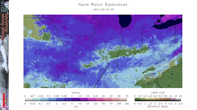
Another one of the tools available on the NSAC site is the analysis that shows the water equivalent of the snow that's on the ground:
Per the image above, anywhere from 2-4 inches of water will be soaking down into the earth's surface in the deep snowpack areas as the snow melts over the coming few days.


No comments:
Post a Comment